Spanning almost two decades, Asakura Robinson’s work has strengthened resilient communities and systems battling climate stress and disasters by empowering them to adapt through policy change, program development and implementation, and on-the-ground projects that protect structures, land, surrounding neighborhoods, and the people that make this City the remarkable place that it is.
The places we plan and design serve multiple uses: they manage stormwater, they create recreational opportunities, they support a thriving ecology, and they improve quality of life. Our integrated practice takes a comprehensive approach to protecting water quality, mitigating urban heat, improving ecological function, and leveraging every opportunity to ensure our communities, ecosystems, and economies are resilient for the years to come. We develop a deep understanding of natural resources in urban places with layered histories and we leverage the environmental and hydrological features to improve water quality through recommendations for wetland plantings and stormwater diversions. At the same time, our recommendations also aim to create a connection between people and places by identifying opportunities to engage and inform communities about the surrounding natural resources.
Since our inception, we have actively engaged in resilient design; however, in the last five years in Houston our efforts have been greatly impacted by Harvey and the role it played on the City, from big picture, system scale strategies down to site specific ecological design, from neighborhood detention basins to bank stabilization efforts, from roadway stormwater quality improvements to Low Impact Development features.
The following are a few projects that showcase our efforts in water strategy and planning pre- and post-Harvey along Buffalo Bayou.
The need for diverting water increases as communities grow. Stormwater runoff can eventually overwhelm city sewers and harm nearby streams and rivers over time through erosion. A common method for managing stormwater is to build a basin, which are meant to collect the water and release it at a rate that prevents flooding or erosion. Along the Bayou, Asakura Robinson led massive efforts to help the City combat stormwater runoff.
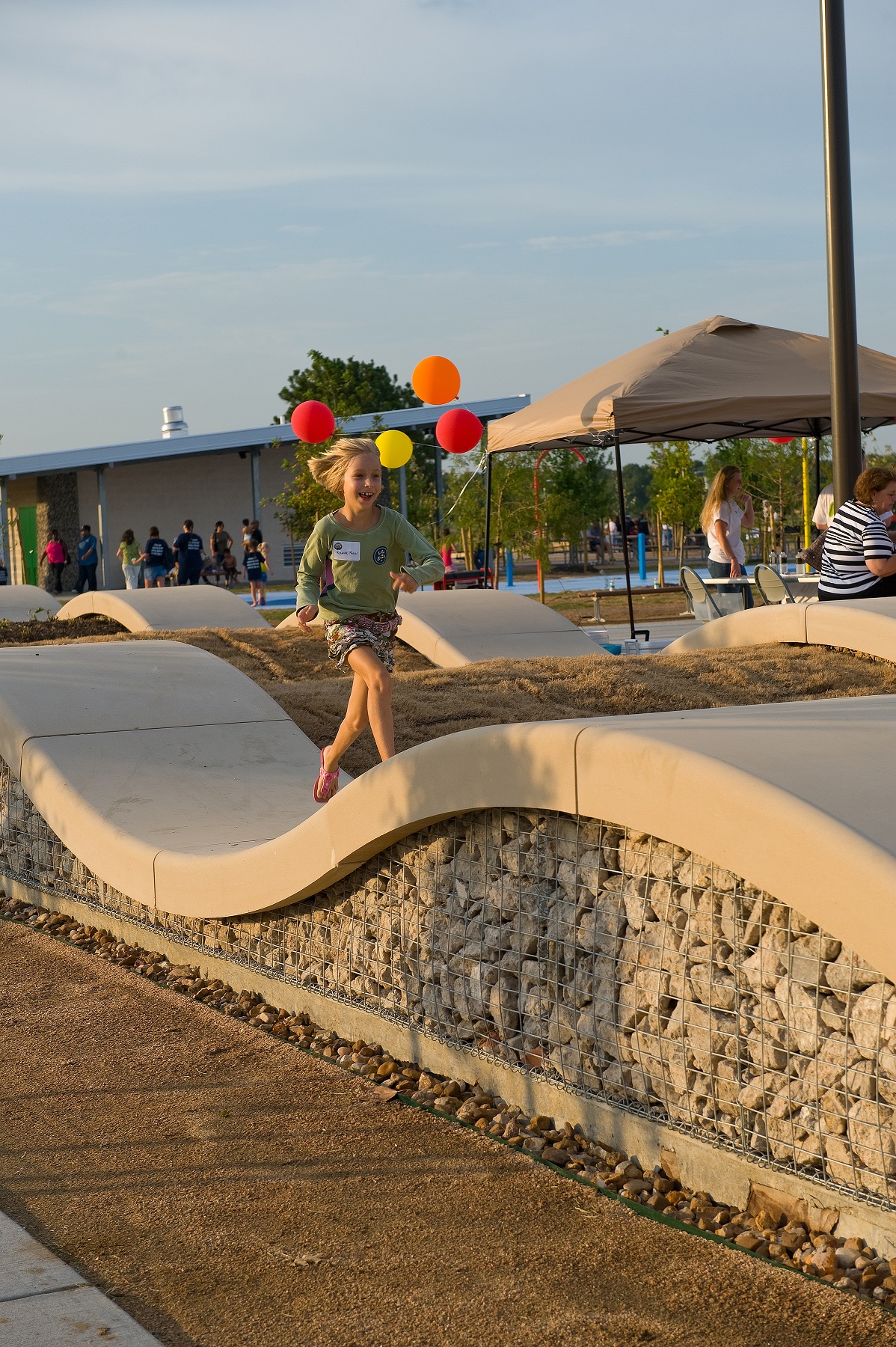
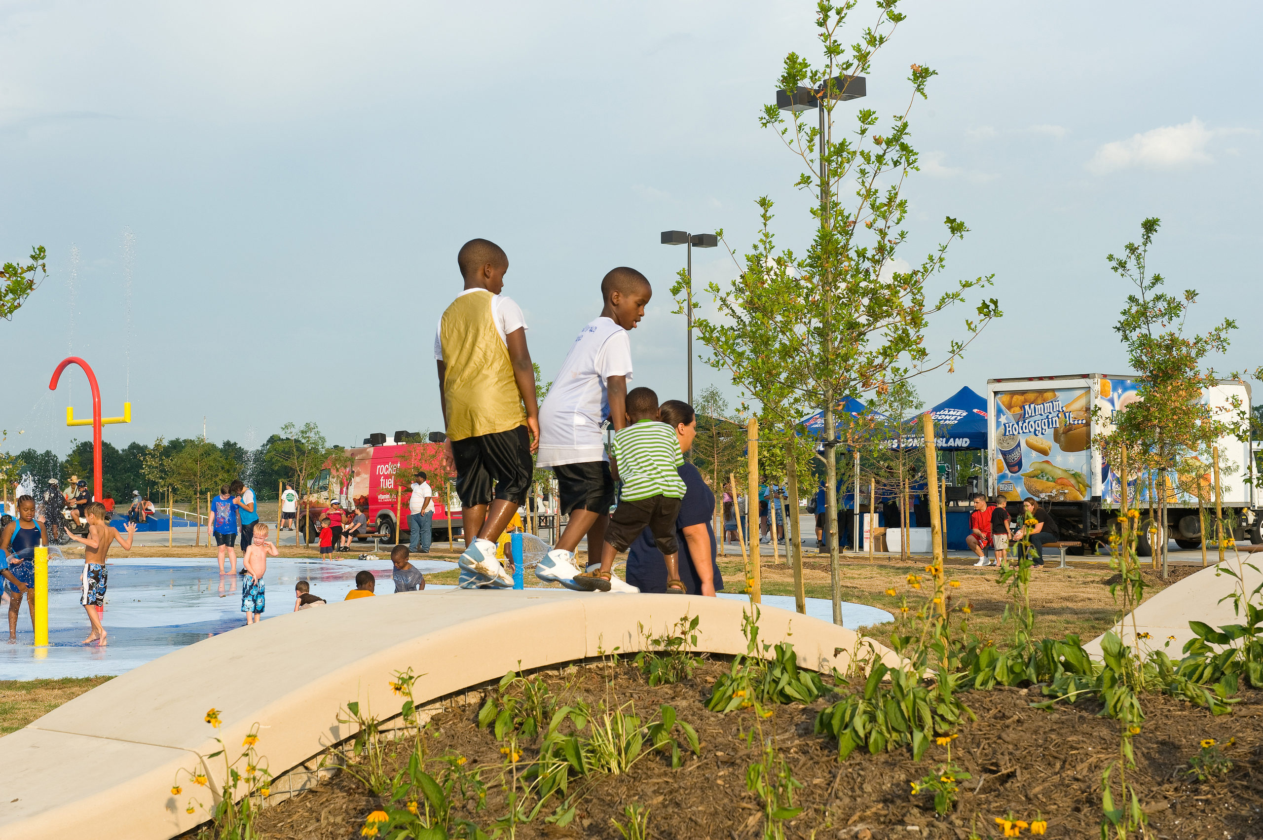
Harris County’s first “green park” and first USGBC LEED registered project, Gene Green Park is 230-acres of parkland in northeast Houston. A large section of the park, 173-acres, is a detention basin for the Harris County Flood Control District (HCFCD). The park’s design incorporates Low Impact Development Techniques in the parking lot with bioswales and meandering streams that dissipate stormwater through native vegetation prior to outfall to Carpenter’s Bayou. Additional LID features include wetland preservation and the use of reduced impervious paving. More than 90% of the construction waste generated was recycled and diverted from landfills, and the project used recycled content for columns, benches, ramps, rolling walls, and amphitheater seating. Gene Green has survived repeated inundation, including Harvey, and remains one of the most popular parks in the Precinct, demonstrating the impact of low impact development.
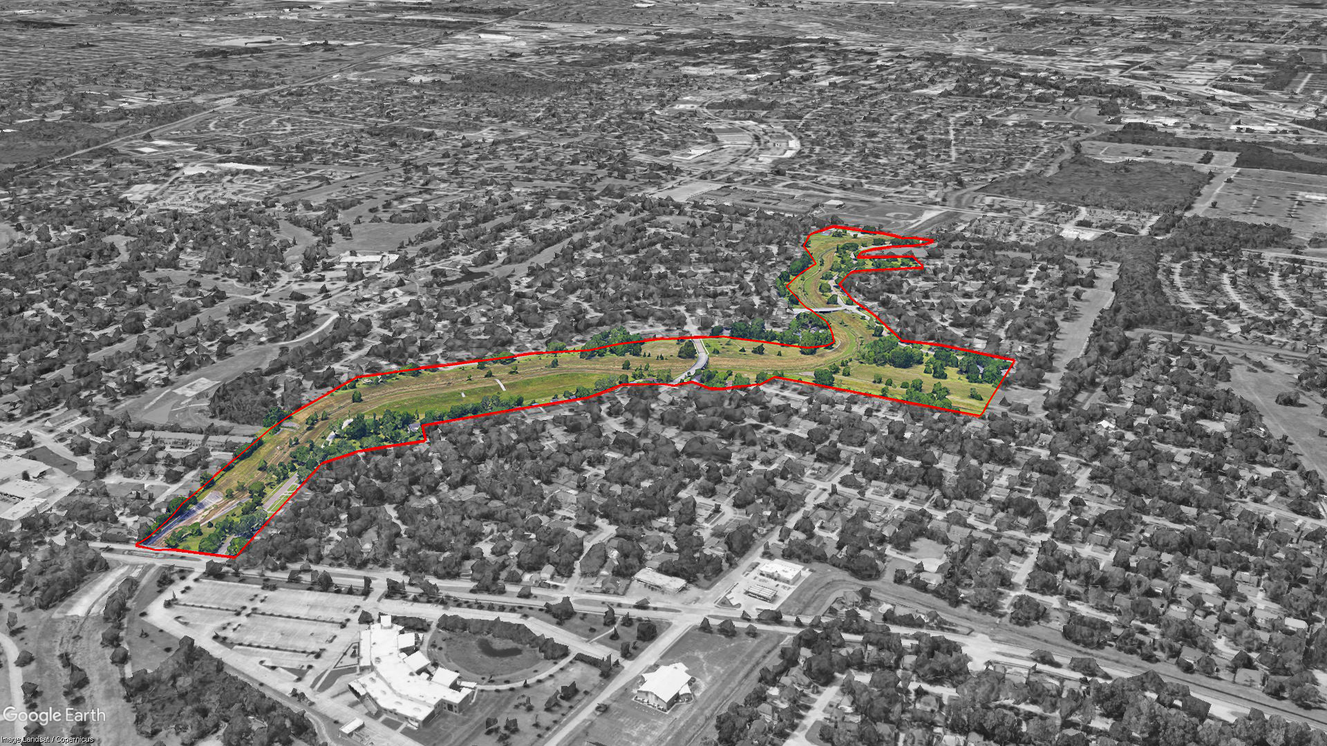
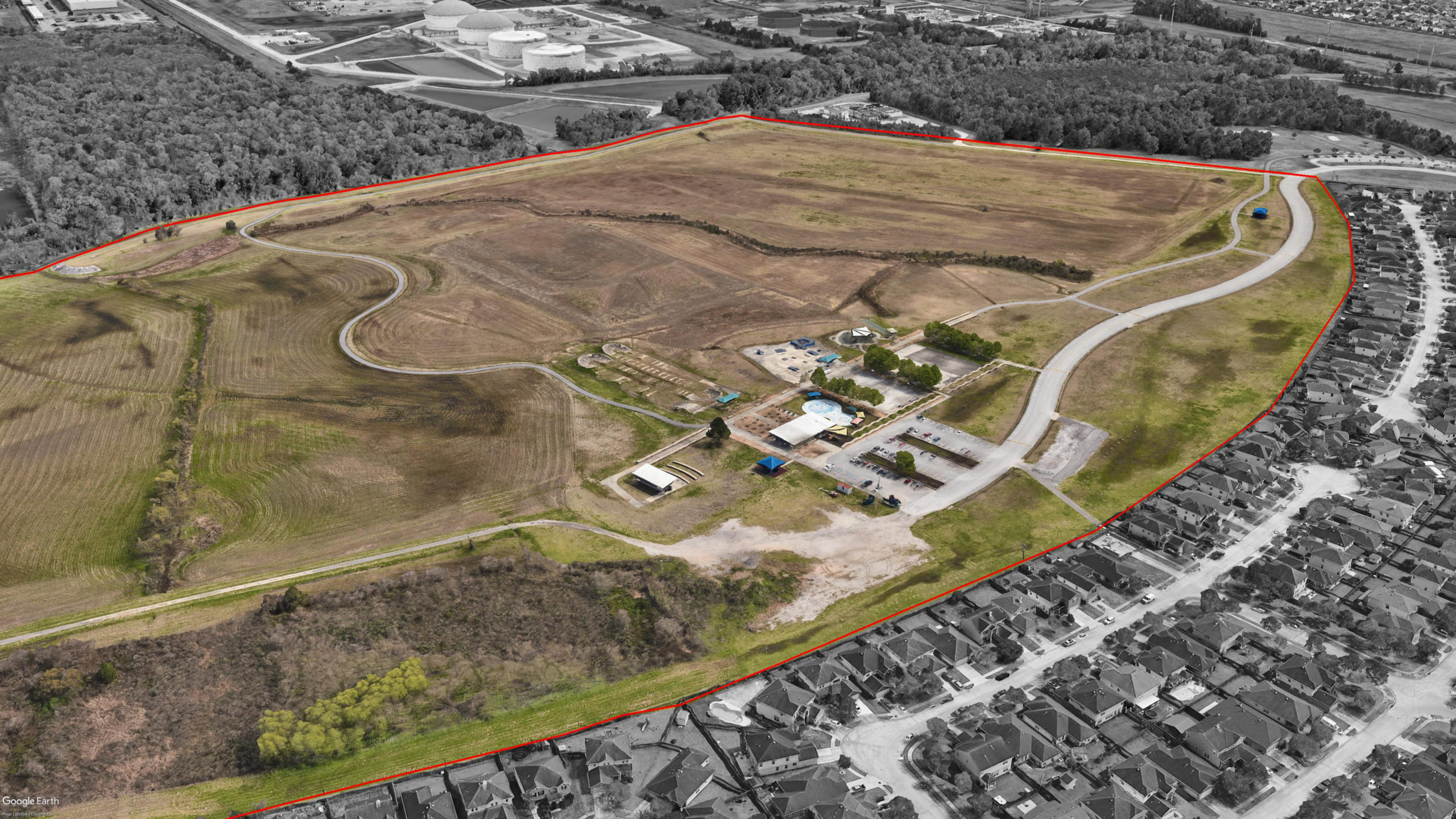
At a glance, the Inwood Forest neighborhood is idyllic. Designed in the 1960s as a suburban paradise with golf course winding throughout, this neighborhood is just minutes from downtown Houston, nestled along the White Oak Bayou with large stands of pre-existing Post Oaks. In 2010, the closure of the golf course only seemed to highlight the natural beauty of this community by leaving behind large trees and swathes of grass intertwined with the houses. But as the daily routine of the former course fell to quarterly mowing and maintenance of water features and low spots disappeared, the pristine links were replaced with wetland edges and scruffy shrub lines. As part of a massive flood mitigation strategy, we Asakura Robinson worked with the City and HCFCD to design a series of 10 connected detention basins that are now able to hold 350 million gallons of stormwater, almost 530 Olympic-sized pools worth of water, which is more water than the Astrodome could hold.
This pilot project is a perfect example of adaptive reuse, as well as serving a dual purpose: it serves the purpose to manage flood control but also serves a function as a park. Through community engagement and stakeholder conversations, AR provided alternate design options for the detention basins to preserve existing site amenities and developed landscape plans for recreational opportunities. These opportunities included a trail network, ecological restoration, a series of pocket parks, and passive recreation opportunities along the planned dry and wet detention basins.
Another water strategy is streambank stabilization. This practice uses vegetation and/or built structural methods used to stabilize and – just as importantly – protect streambanks and shorelines. Streams with well-established vegetation on their banks provide for better water quality and wildlife habitats. Vegetation is extremely important for the biological and physical health of any stream as well as the stability of the system as a whole. When natural vegetation is combined with sustainable materials and structures, a variety of techniques can be employed for streambank erosion control.
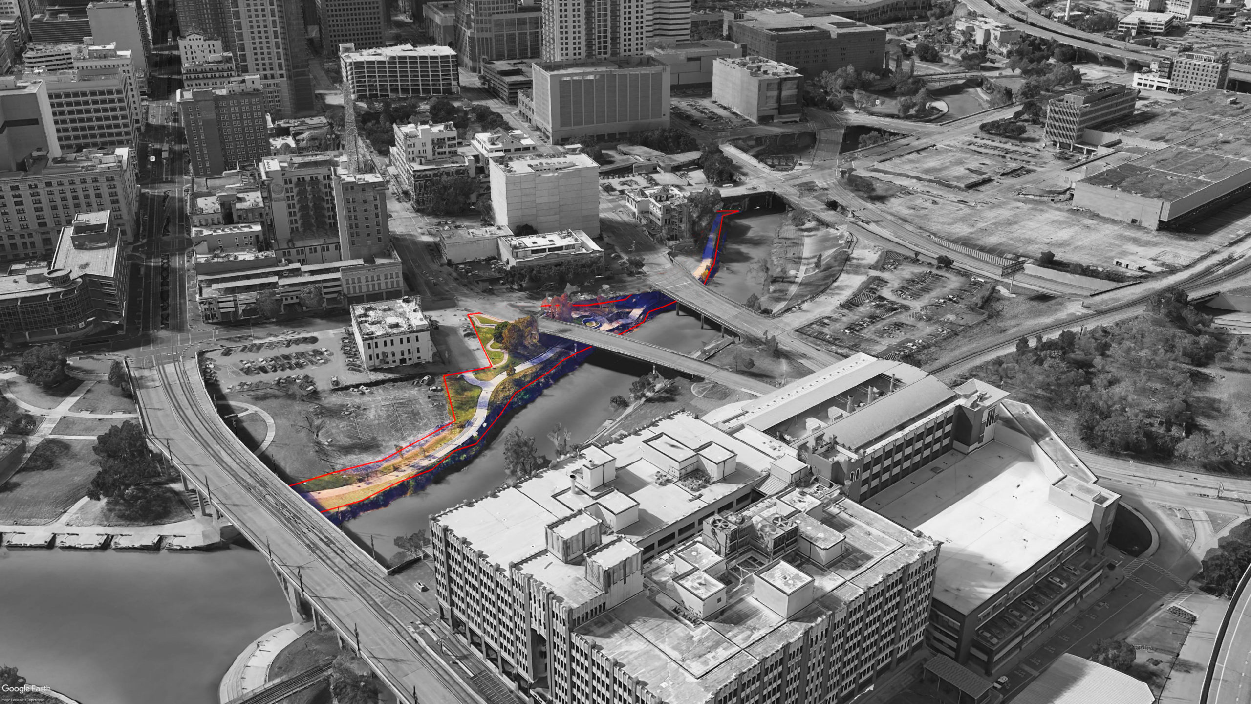
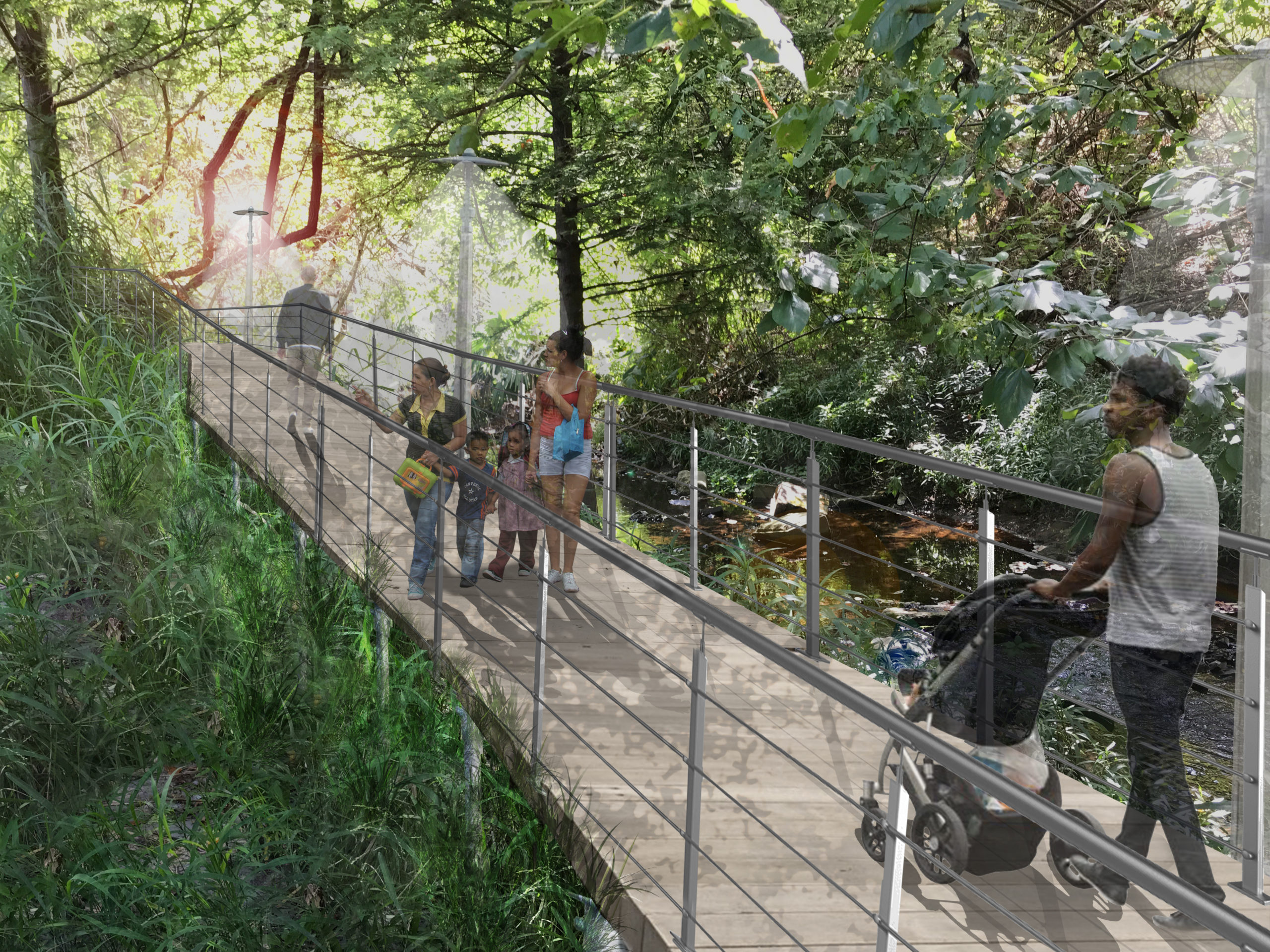
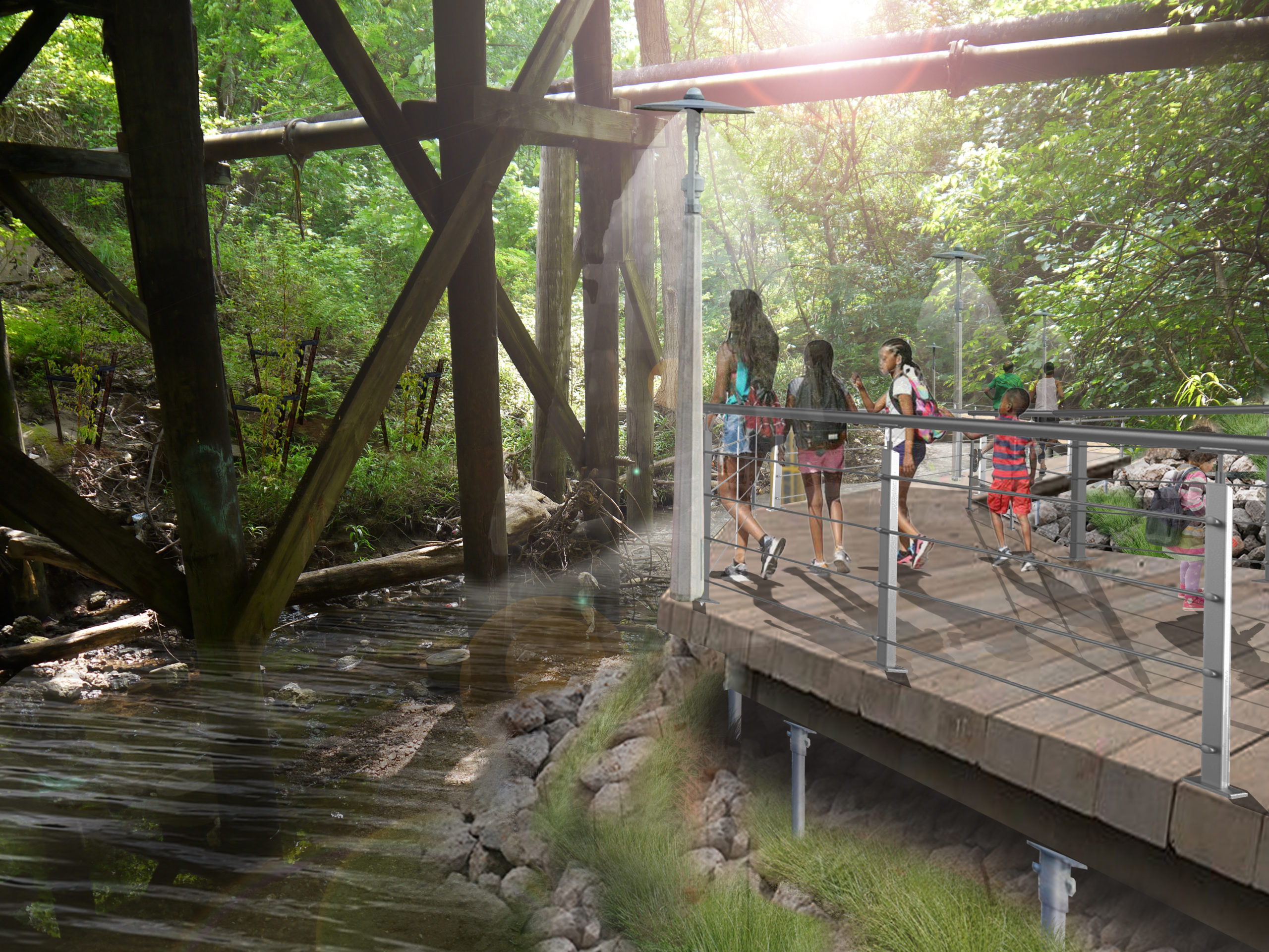
TIGER Trail 4 re-imagines the relationship between trail infrastructure and the natural forces of Buffalo Bayou in Downtown Houston. We designed a plan to re-stabilize the embankment for Downtown’s premiere hike and bike trail along Buffalo Bayou. After Hurricane Harvey, the south embankment of the Bayou experienced major erosion and had continued to erode with subsequent major rain events. Continual erosion and scouring led to a partial failure of the existing trail system and its amenities.
This project re-established the south bank from Franklin Street to Main Street with strengthened erosion protection measures to prevent similar erosion from future significant rain events and flash flooding. Our team worked closely with engineers to propose an additional scenario- a bioengineering solution. We proposed regrading the embankment of the bayou to its equilibrium slope, stabilizing it through a hybrid of planting and engineered solutions, while the trail spans over the embankment as an elevated deck. This alternate design acknowledged the historical methods of channelizing the bayou and provided a solution that reframes how the City interacts with and perceives the bayou.
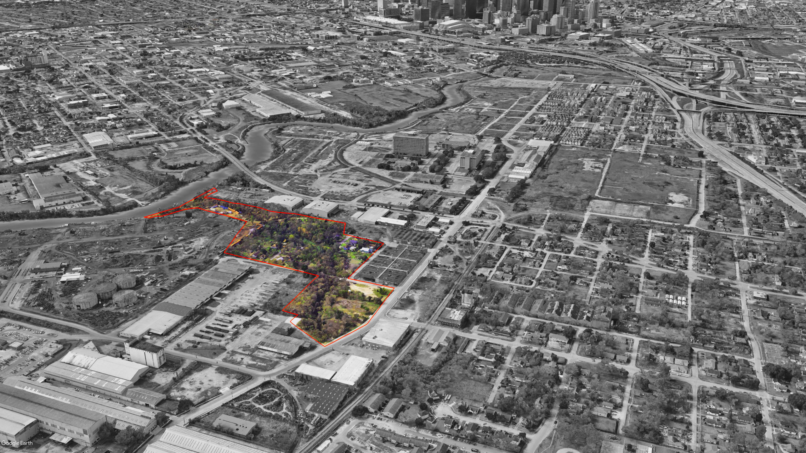
Stretching into the Fifth Ward, Japhet Creek is a small, peaceful tributary stream that offshoots from Buffalo Bayou east of Downtown. Residents who explore the area find the creek’s steep banks lined with lush vegetation and a dense tree canopy that provides cooling shade. Because it is mostly hidden from the surrounding neighborhood, many people don’t even know it sits right in their own backyard. Asakura Robinson has teamed with the Buffalo Bayou Partnership to ensure that those who want to enjoy more of the Japhet Creek Greenway have the chance to do so. The firm is providing a master plan and design development in order to bring Japhet Creek to the public by eliminating invasive plants and removing accumulated debris in order to give the creek back its life. The plan looks at the creek’s natural drainage patterns and employs strategies that will help manage stormwater, mitigate flooding, reduce risk for local residents and landowners, and stabilize the bayou’s banks. Once in place, the plan will prevent erosion along the banks by replacing invasive species with native plants, expanding the tree canopy, and developing new green spaces without compromising biological diversity.
Stormwater solutions that employ low-impact development (LID) and other green infrastructure (GI) techniques are utilized as cost-effective and resilient alternatives to traditional methods. LID and other GI practices integrate natural systems like vegetation and soil into water treatment devices to control the quality and quantity of urban runoff. Benefits include stormwater control, water conservation, urban heat island cooling, natural habitat, and beautification.
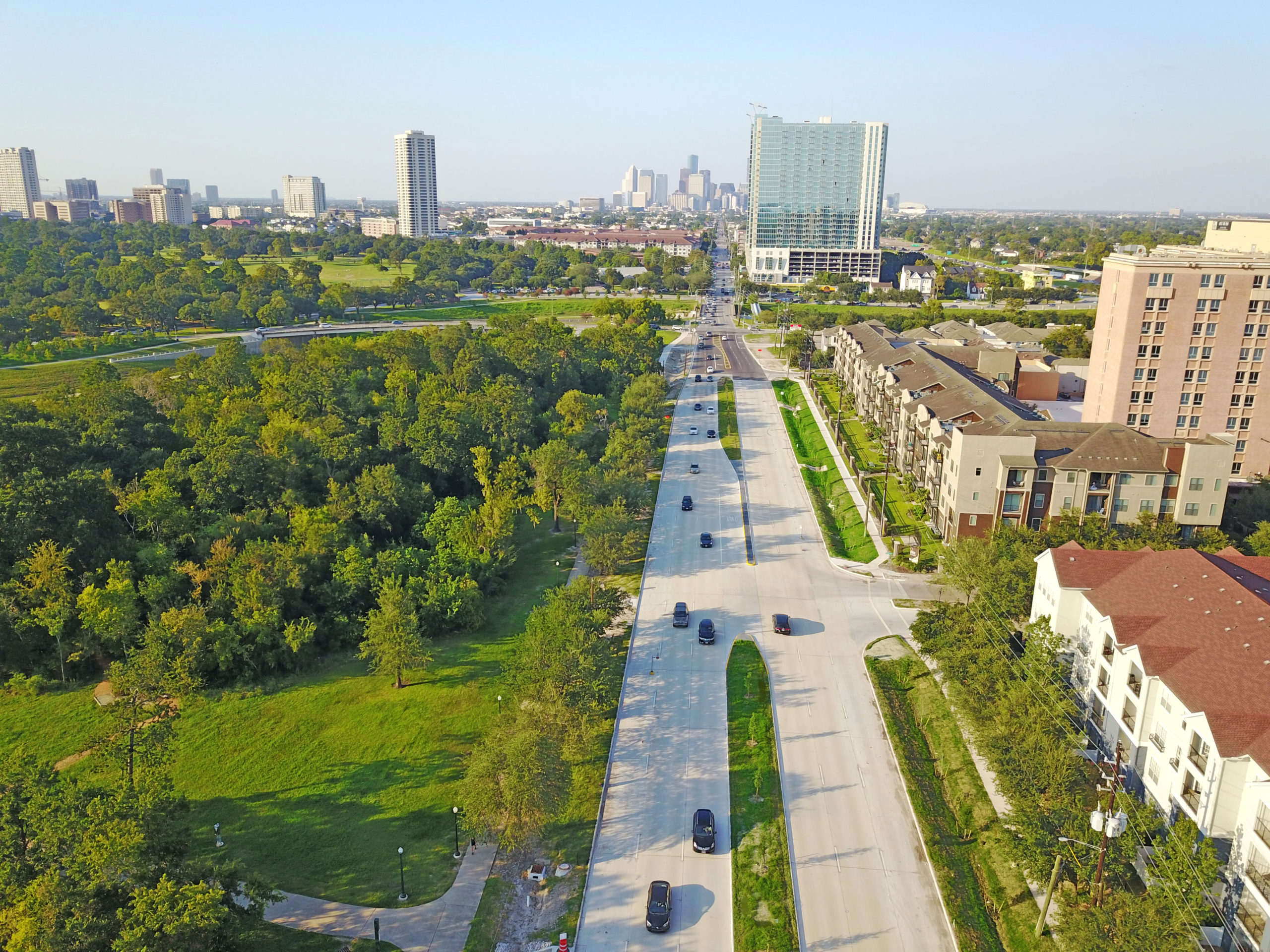
Almeda Road was originally designed to be a major highway corridor with a 160-wide right-of-way, utilizing a median with wide shoulders for drainage and future expansion. Asakura Robinson worked with the City of Houston and Walter P Moore on a low-impact design solution to not only improve drainage and water quality benefits inherent in LID projects, but also to improve traffic flow, accessibility and encourage cyclists to travel along the road. A pilot project for Green Road Design, key features included roadside plantings and engineered soil mixes that filter stormwater to meet stormwater quality goals, along with grass swales that were designed to intercept and treat flush runoff. The new design features a narrowed central median expanding the four lane roadway to six lanes with a varying ROW. This not only improves traffic flow at signalized intersections but will also provide additional green space for pedestrians and bicyclists. A potential 10’ wide bikeway is proposed along one side of the ROW adjacent to Hermann Park and the VA Hospital.